256
FXUS66 KSGX 281749
AFDSGX

Area Forecast Discussion
National Weather Service San Diego CA
1049 AM PDT Tue Apr 28 2026

.SYNOPSIS...
High temperatures will be much warmer for inland areas today, as
much as 10 to 15 degrees warmer for the mountains. Only slight
warming for Wednesday with high temperatures remaining around
average on Thursday as a low pressure system moves inland to the
south. There will be additional warming for Friday and Saturday
with Saturday high temperatures 5 to 10 degrees above average for
inland areas. A low pressure system moving slowly inland into
California early next week will bring cooling for Sunday through
Tuesday with Tuesday high temperatures near average near the coast
to a few degrees below average for the mountains and deserts.
There is also a chance for showers early next week.

&&

.DISCUSSION...FOR EXTREME SOUTHWESTERN CALIFORNIA INCLUDING ORANGE...
SAN DIEGO...WESTERN RIVERSIDE AND SOUTHWESTERN SAN BERNARDINO
COUNTIES...

New Aviation and Marine Discussion...

.SHORT TERM (Today through Thursday)...
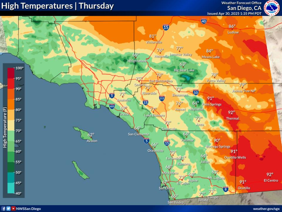
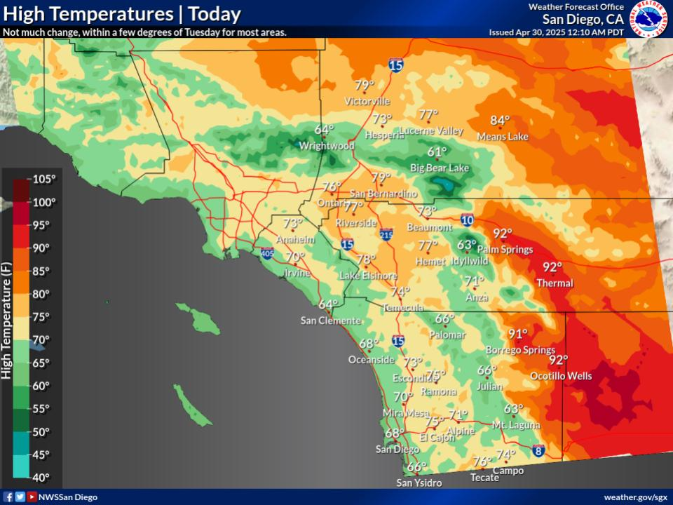
High temperatures for today will be much warmer than Monday, as
much as 10 to 15 degrees warmer for the mountains. Inland high
temperatures will still be a few degrees below average with high
temperatures today ranging from the mid to upper 60s near the
coast to the 70s for the Inland Empire with the lower deserts in
the mid 80s. There will be slight slight additional warming for
Wednesday. High temperatures will remain around average on
Thursday as a low pressure system moves inland to the south.

&&

.LONG TERM (Friday through Monday)...
High pressure will bring greater warming for Friday and Saturday
with Saturday high temperatures 5 to 10 degrees above average for
inland areas. High temperatures on Saturday will range from the
lower 70s near the coast to the mid 80s to lower 90s for the
Inland Empire with the lower deserts in the upper 90s to around
100.

A low pressure system centered off the California coast on Sunday
will move slowly inland on Monday and Tuesday. Cooling will spread
inland with Tuesday high temperatures near average at the coast to
around 5 degrees below average for the deserts. High temperatures
on Tuesday will range from the mid to upper 60s near the coast to
the lower to mid 70s for the Inland Empire with the lower deserts
in the 80s. There is also a slight chance of showers for early
next week.


&&

.AVIATION... 281730Z....Winds will pick up after 22-23Z in the
mountain passes and adjacent deserts with gusts up to 25-30 kts. Low
clouds begin to trickle in along the coast after 02-03Z Wednesday,
filling in and pushing inland slightly after 07Z. Cloud bases are
expected to be around 2000-3000ft MSL. Otherwise, VFR conditions and
SCT-BKN high clouds expected through the TAF period.
.

&&

.MARINE...
No hazardous marine conditions are expected today through Saturday.

&&

.SKYWARN...
Skywarn activation is not requested. However weather spotters are
encouraged to report significant weather conditions.


&&

.SGX WATCHES/WARNINGS/ADVISORIES...
CA...None.
PZ...None.

&&

$$

PUBLIC...17
AVIATION/MARINE...Villafane


